Home
About
Mission
What We Do
Partners
Projects
Officers
Calendar
Events Gallery
Suggestions & Comments
Contact
Join Now
Collection
Document Archive
Photo Galleries
Video Presentations
Map Gallery
IGS Presentations
IGS Member Genealogies
Stories, Narratives & Histories
Newsletter
Submissions
Resources
IGS Genealogy 101
Genealogy Web Sites
Native Genealogy
Recommended Reading
How to Use Our Website
Site Map
Ask a Researcher
Zoom Meeting
News
Iroquois Genealogy Society
Home
About
Mission
What We Do
Partners
Projects
Officers
Calendar
Events Gallery
Suggestions & Comments
Contact
Join Now
Collection
Document Archive
Photo Galleries
Video Presentations
Map Gallery
IGS Presentations
IGS Member Genealogies
Stories, Narratives & Histories
Newsletter
Submissions
Resources
IGS Genealogy 101
Genealogy Web Sites
Native Genealogy
Recommended Reading
How to Use Our Website
Site Map
Ask a Researcher
Zoom Meeting
News
Collection
Document Archive
Photo Galleries
Video Presentations
Map Gallery
IGS Presentations
IGS Member Genealogies
Stories, Narratives & Histories
Newsletter
Submissions
View fullsize
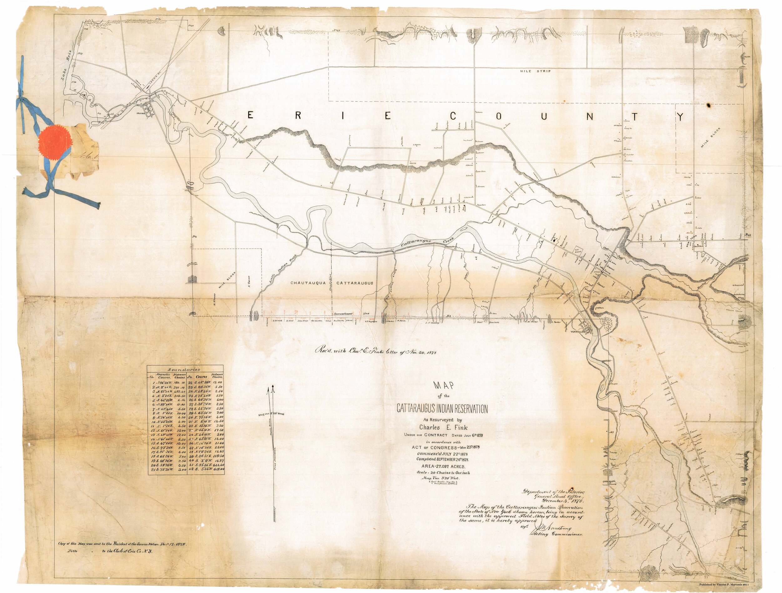
Cattaraugus Territory 1878
View fullsize
Cattaraugus Territory 1890
View fullsize
Allegany Territory 1890
View fullsize
Tonawanda Territory 1890
View fullsize
Onondaga Territory 1890
View fullsize
St. Regis Territory 1890
View fullsize
The Five Indian Nations of Canada 1747
View fullsize
Kane-audea Territory, Seneca Nation September 3rd 1798
View fullsize
Squawky-hill Territory, Seneca Nation September 10 1798
View fullsize
Canawagus Territory, Seneca Nation September 30 1798
View fullsize
Gardeau Territory, Seneca Nation September 10 1798
View fullsize
Big-tree and Little-Beards Town, Seneca Nation September 24 1798
View fullsize
Map of the Township of Carrollton, New York, 1869
View fullsize
Map of Allegany and Limestone, New York, and surrounding areas, 1869
View fullsize
Maps of Cold Spring, Carrollton, and Steamburg, New York, 1869. Maps include Steamburg and Carrollton business directories.
View fullsize
Map of Portville, New York and the township of Salamanca, New York, 1869. Maps include corresponding business directories.
View fullsize
West Part of Collins [Village]; Collins [Township] Erie County Atlas 1880 F.W. Beers & Co.
View fullsize
Farnham Station Brant [Village]; Brant [Township]; Brant Center [Village]
View fullsize
Country of the Five Nations
View fullsize
Map of the Province of New York 1771
View fullsize
Six Nations Homeland Map
View fullsize
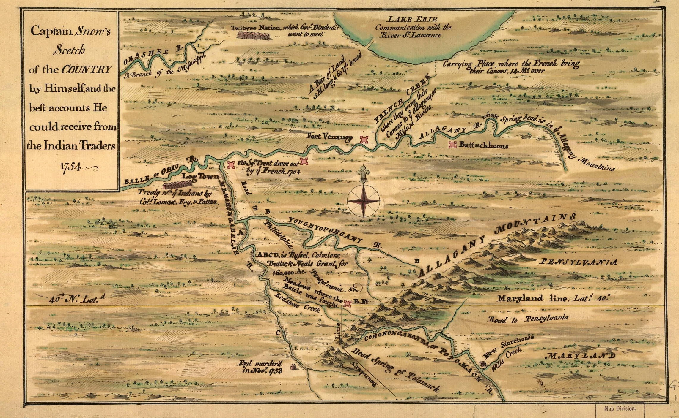
Captain Snows Sketch of the Country 1754
View fullsize
Bonne Camp Map 1749
View fullsize
Land of John O' Bail
View fullsize
Robert Morris Purchase, 1804
View fullsize
Kent Map, 18th Century Indian Towns Pennsylvania.
View fullsize
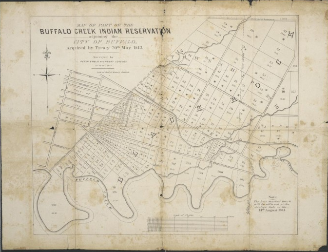
Buffalo Creek Territory 1842
View fullsize
Seneca Territory 1797
View fullsize
Five Nations and Mission Sites 1656-1684 from book by John S. Clark 1879
View fullsize
Morris Map 1800
View fullsize
Guy Johnson Map 1771
View fullsize
Lewis Evans Map 1755
View fullsize
Lewis Evans Map 1755-1775
View fullsize
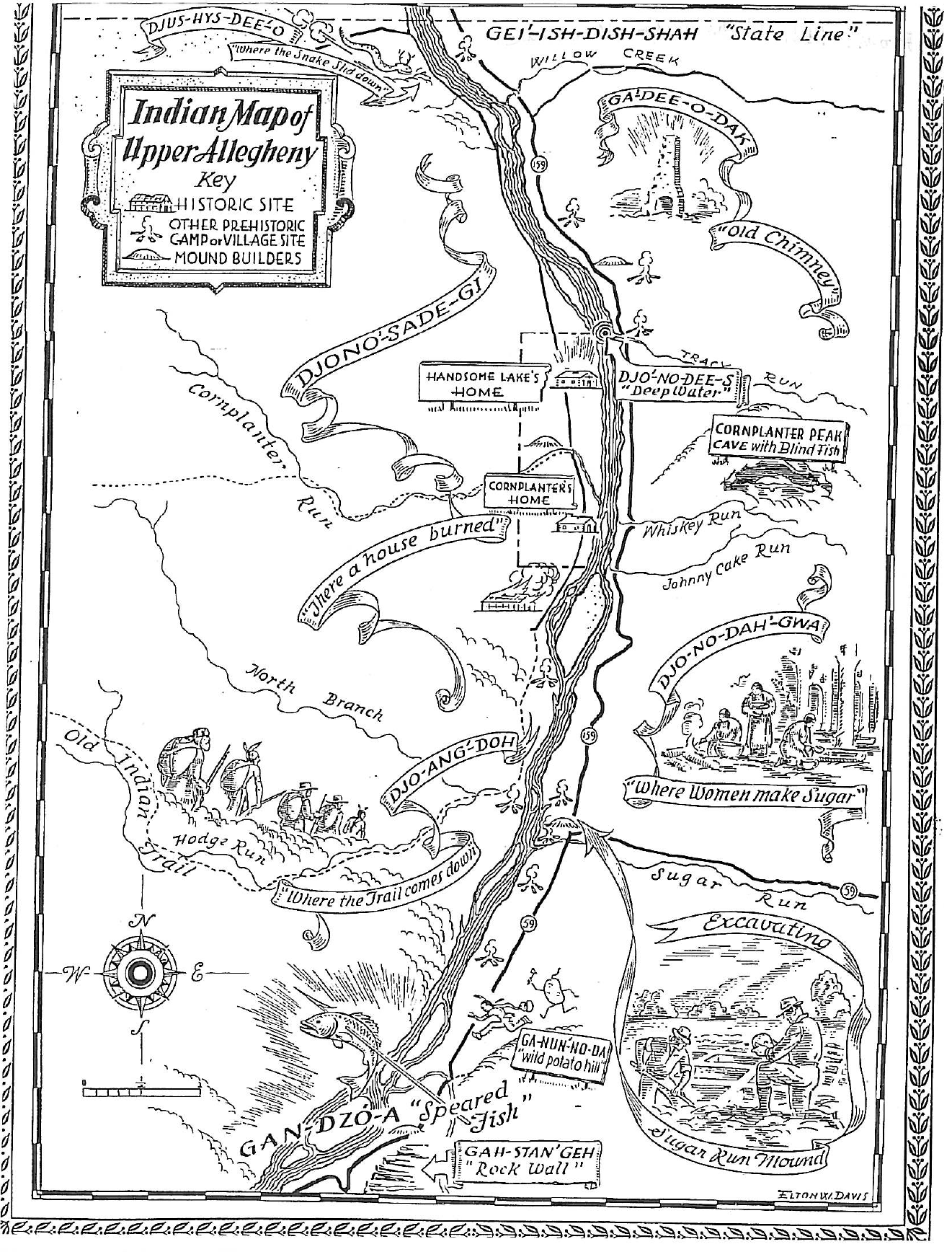
Warren Almanac Map 1941
View fullsize
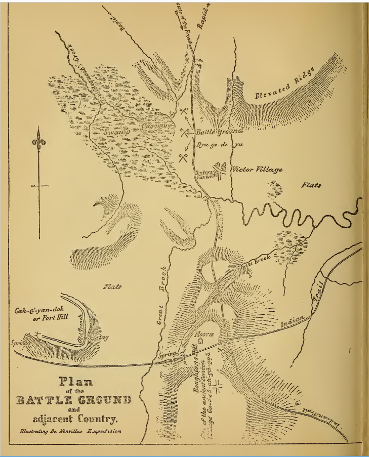
Denonville Map of Battle Ground near Victor, New York
View fullsize
Pouchot Map 1758
View fullsize
Territory of American Indians circa. 1600
View fullsize
Western New France 1688
View fullsize
CattaraugusTerritory from Map of Erie County, New York from actual surveys
View fullsize
Map of Phelps and Gorham Purchase 1802–1806


![West Part of Collins [Village]; Collins [Township] Erie County Atlas 1880 F.W. Beers & Co.](https://images.squarespace-cdn.com/content/v1/5b9337ac75f9ee5fa8f6f2cd/1539738679741-974O5ATCZFR6T80ZGK53/West+Part+of+Collins+%5BVillage%5D%3B+Collins+%5BTownship%5D+Erie+County+Atlas+1880+F.W.+Beers+%26+Co..jpg)
![Farnham Station Brant [Village]; Brant [Township]; Brant Center [Village]](https://images.squarespace-cdn.com/content/v1/5b9337ac75f9ee5fa8f6f2cd/1541117652437-OV3DRYMB7714XQ8RM0JZ/Farnham+Station+Brant+%5BVillage%5D%3B+Brant+%5BTownship%5D%3B+Brant+Center+%5BVillage%5D.jpg)